
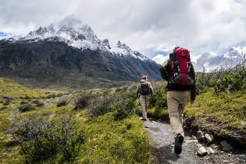
The Babadağ Summit Trail ascends to 1,969 metres above sea level from the slopes overlooking Ölüdeniz in the Fethiye district of Muğla, making it the highest accessible summit hike in the immediate region. Babadağ is internationally known as one of the world's premier paragliding launch sites, but the mountain also rewards hikers willing to earn the elevation on foot. The trailhead is located above Ölüdeniz village, accessible by taxi from Ölüdeniz Beach (approximately ₺150). Paragliding minibuses also run to the launch point on the upper mountain and hikers can purchase a seat on these vehicles; the launch site sits at approximately 1,750 metres, reducing the hiking gain considerably for those who opt for shuttle-assisted access. The full hike from the lower trailhead covers 12 kilometres round-trip with a total elevation gain of approximately 1,800 metres — placing it firmly in the demanding category. The trail surface transitions from rocky pine forest track at lower elevations to open limestone ridgeline with sparse vegetation, scree fields, and wind-exposed sections on the upper mountain. Navigation requires care on the upper ridge where the path becomes less distinct. A navigation app (Komoot or AllTrails) with offline maps is strongly recommended. The summit at 1,969 metres offers a 360-degree panorama encompassing Ölüdeniz lagoon, the Greek island of Rhodes to the southwest, the Taurus mountain ranges to the north, and the full sweep of the Fethiye coastline. Paragliders can be observed launching from the adjacent ramp throughout the day. There are no water sources, shelter huts, or refuges on the mountain. The round-trip from the lower trailhead takes 6–8 hours for a fit hiker. An early start — no later than 06:00 from the trailhead — is essential to summit before afternoon thunderstorms develop in summer and to return before dark.
| Distance | 12 km round trip |
|---|---|
| Duration | 6–8 hours |
| Difficulty | expert |
| Trailhead | Taxi from Ölüdeniz to trailhead (~₺150/$4.50); paragliding operators also run minibuses to launch point (buy ticket separately from a paragliding company) |
| Best season | May–June, September–October |
| Address | Babadağ, 48300 Fethiye, Muğla (trailhead above Ölüdeniz) |
Trail facts
- Trail area
- Fethiye
What to bring
- Full hiking boots
- 3–4L water
- Warm layer (summit is windy and cool)
- Navigation app (Komoot or AllTrails)
- Headlamp for early starts
Location
Babadağ, 48300 Fethiye, Muğla (trailhead above Ölüdeniz)
36.5283, 29.1258 View on map
Highlights
- Summit panorama at 1,969 m encompassing Ölüdeniz lagoon, Rhodes, and the Taurus mountains
- Paragliders launching from the adjacent ramp — one of the world's premier tandem launch sites
- Transition from pine forest to exposed limestone ridgeline with increasingly wild mountain terrain
- 1,800 m elevation gain offering a genuine high-mountain experience within reach of a beach resort
Tips for visiting
- Start the full ascent no later than 06:00 — afternoon summer thunderstorms can build quickly above 1,500 m and the descent requires daylight.
- Carry 3–4 litres of water — there are no sources on the mountain above the village outskirts.
- A warm layer is essential even in summer; summit temperatures can be 15°C cooler than Ölüdeniz and the ridge is consistently windy.
- Download an offline navigation map before departure — trail markings thin out on the upper ridge.
- Consider the paragliding minibus shuttle to the 1,750 m launch site to reduce the ascent to a manageable 2-hour hike rather than a full day.
When to visit
May through early June and September through October offer the most stable conditions — temperatures are moderate, afternoon thunderstorms are less frequent, and the trail surface is dry. July and August are possible but demand a pre-dawn start to avoid heat and storm risk on the upper mountain.
Accessibility
Babadağ is not accessible to wheelchair users or those with mobility impairments. The 1,800 m elevation gain, loose scree, and poorly marked upper ridge require good fitness and surefootedness. The paragliding launch area at 1,750 m is reachable by private vehicle or operator minibus for those who cannot undertake the full ascent.
Frequently asked questions
How long does the full Babadağ hike take?
The full round-trip from the lower trailhead to the 1,969 m summit and back takes 6–8 hours for a fit hiker at moderate pace. Those using the paragliding minibus shuttle to the 1,750 m launch site can reach the summit in approximately 1.5–2 hours from the drop-off point.
Is it possible to paraglide down after hiking up?
Yes — hikers who walk up to the launch site can book a tandem paragliding flight down to Ölüdeniz beach with one of several licensed operators. This must be arranged and paid for separately from the hiking activity, and flights are weather-dependent.
Is a guide required to summit Babadağ on foot?
A guide is not mandatory, but the upper ridge is poorly marked and route-finding errors can lead to difficult terrain. Solo hikers should carry an offline navigation app, leave a route plan with someone, and avoid the summit in poor visibility.
What are the main hazards on Babadağ?
The principal hazards are afternoon thunderstorms (fast-moving in summer), sun exposure on the unshaded upper ridge, and navigation errors on the upper limestone terrain. The return descent involves loose scree that is tiring on the knees.
When should Babadağ not be hiked?
The mountain should be avoided when cloud is building by mid-morning (thunderstorm risk), immediately after rain (slippery limestone), and in winter when snow can persist on the upper ridge. The trail is safest from May through October.