
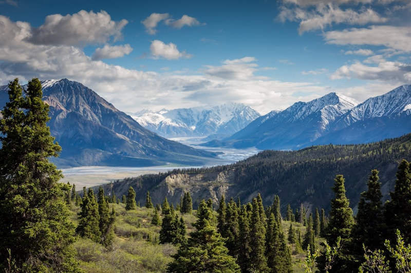
The Meilin Reservoir to Danaoke Hill trail climbs from the Meilin Mountain trailhead near Mei'ao Road in Futian District up to the roughly 350m Danaoke Hill summit, with an option to loop back via the Meilin Greenway. The trailhead is reached by Shenzhen Metro Line 9 to Meilin Station, Exit D, followed by a 15-minute walk; there is no permit requirement and no entry fee. Depending on the chosen route, the outing covers 6-9km with a moderate, sustained elevation gain of around 300m from the reservoir area to the summit, on a surface that mixes dirt paths, stone steps, and short paved greenway sections near the reservoir. The lower stretch beside Meilin Reservoir is well shaded by forest and relatively flat, while the climb toward Danaoke Hill becomes steeper and rockier with patches of exposed trail near the top. Key landmarks include the reservoir dam viewpoint at the start, a mid-route junction where hikers can choose the shorter reservoir loop or continue to the summit, and the Danaoke Hill summit itself, which offers views over Futian District and the Shenzhen River toward Hong Kong on clear days. There are no refuge huts along the route, though benches appear at intervals near the reservoir, and the only reliable water access is at the trailhead. The full route to the summit and back typically takes 3-4 hours.
| Distance | 6-9km depending on route, Meilin Reservoir entrance to the Danaoke Hill summit and Meilin Greenway |
|---|---|
| Duration | 3-4 hours |
| Difficulty | moderate |
| Trailhead | Shenzhen Metro Line 9 to Meilin Station, Exit D, then a 15-minute walk to the trailhead |
| Best season | October to April for cooler hiking conditions |
| Address | Meilin Mountain trailhead, near Mei'ao Road, Futian District, Shenzhen, Guangdong, China |
Trail facts
- Trail area
- Meilin Mountain, Futian District
What to bring
- Hiking shoes
- 2 litres of water
- Sun protection
- Light rain layer
- Trail snacks
Location
Meilin Mountain trailhead, near Mei'ao Road, Futian District, Shenzhen, Guangdong, China
22.5709, 114.0949 View on map
Highlights
- Meilin Reservoir dam viewpoint at the trailhead
- Danaoke Hill summit views toward the Shenzhen River and Hong Kong
- Shaded, flat reservoir-side path suitable for warm-up walking
- Option to shorten the hike via the reservoir loop junction
- Mixed dirt, stone-step, and greenway surfaces
Tips for visiting
- Carry 2 litres of water, since the trailhead is the only reliable refill point
- The reservoir loop is a good bail-out option if the summit push feels too strenuous
- Hike October to April for cooler temperatures on the exposed upper slope
- Wear hiking shoes with grip for the stone steps near the summit
- Weekday mornings are quieter than weekend afternoons near the reservoir
When to visit
Cooler months from October to April, hiked in the morning, make the climb to Danaoke Hill more comfortable.
Accessibility
The flat reservoir-side section is walkable for those with limited mobility, but the climb to the Danaoke Hill summit is not wheelchair- or stroller-friendly.
Frequently asked questions
Can this hike be shortened?
Yes, a mid-route junction lets hikers loop back around the reservoir without continuing to the Danaoke Hill summit.
How difficult is the climb to Danaoke Hill?
It is a moderate hike with about 300m of elevation gain on dirt and stone-step terrain, manageable for hikers with some fitness.
Is there shade along the trail?
The reservoir-side section is well shaded by forest, though the final climb to the summit has more exposed, rockier terrain.
What can be seen from the summit?
Danaoke Hill's summit offers views over Futian District and the Shenzhen River, extending toward Hong Kong on clear days.